Ultimate Guide to Visiting Zion National Park
A Landscape Dominated by Steep Red Cliffs & The Virgin River
Zion holds a special place in the heart of Utahans. It is the oldest and most visited park in the state and one of the most incredible.
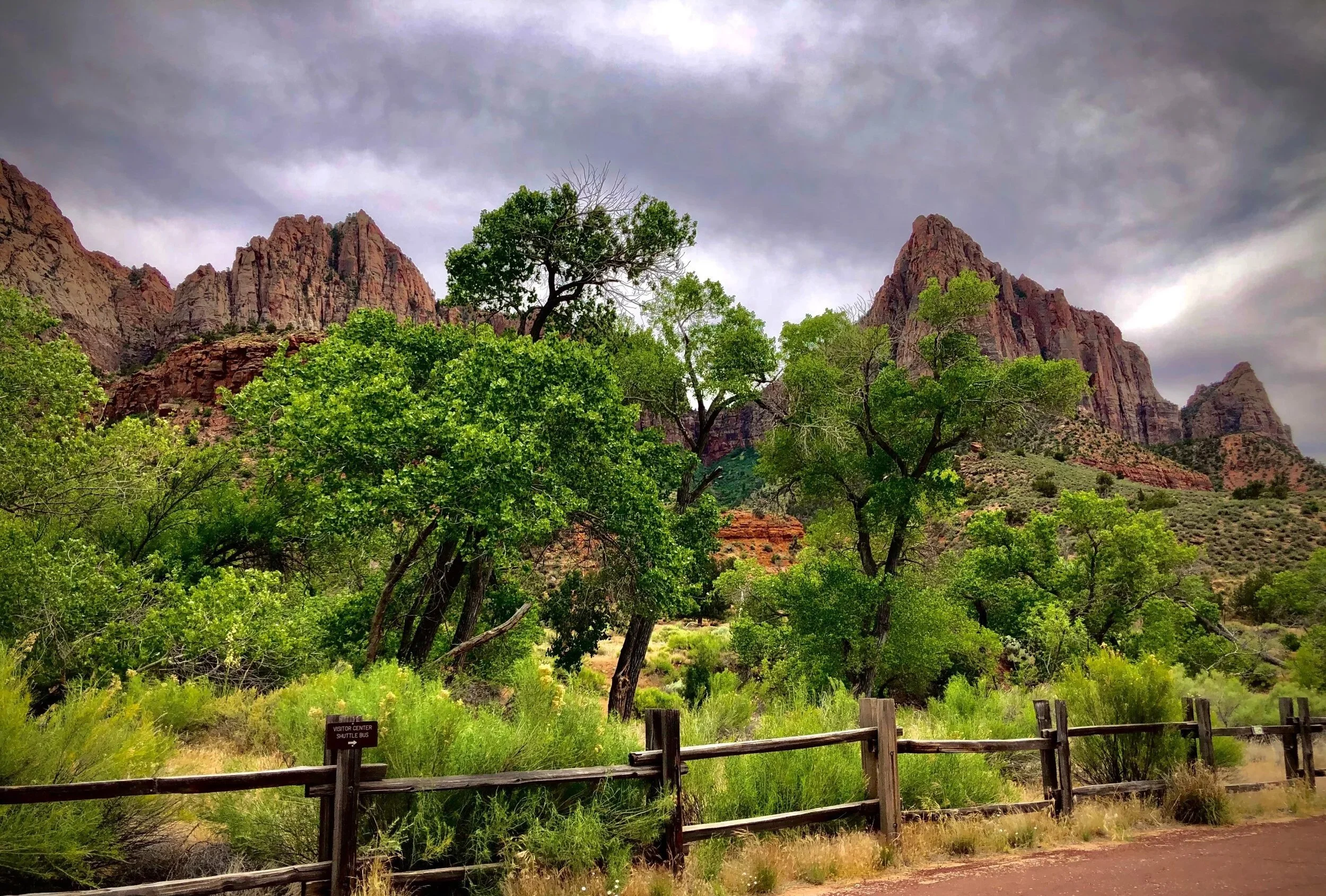
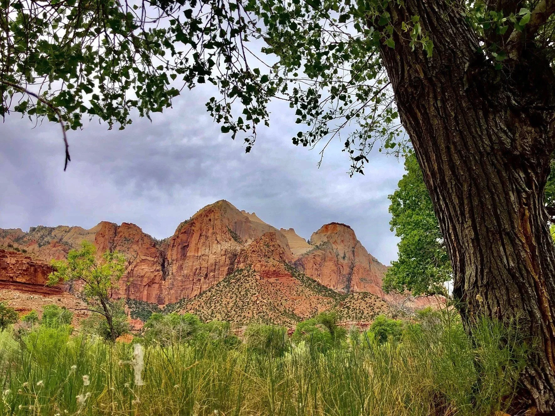
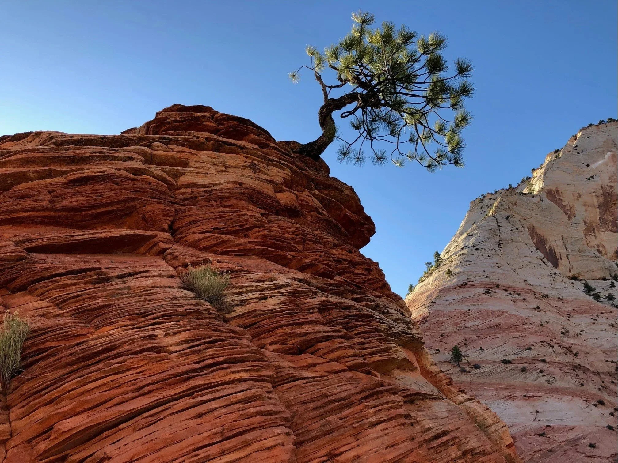
The park is dominated by Navajo sandstone rock in deep shades of fiery red. The canyon itself was carved by the Virgin River, a deep chasm with nearly vertical walls that tower high above you as you wander along the river’s edge.
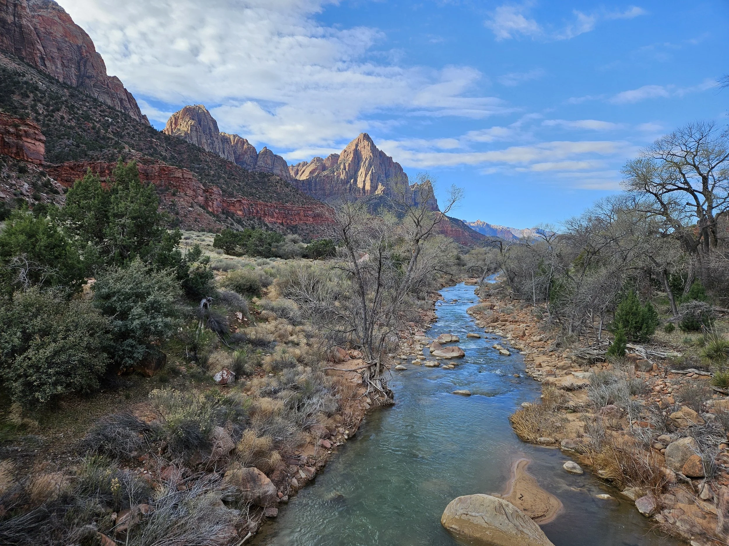
It’s the perfect place for a leisurely stroll along the riverbank or a rigorous hike up sheer cliff walls to vantage points with sweeping views overlooking the valley below.
You can hike the infamous Narrows in waste high water or take a scenic drive to the east end of the park with its checkerboard mesas where you will undoubtedly spot the park’s native agile climbers, the big horn sheep, scaling the steep rocky slopes.
Zion National Park at a Glance
📍 Location: Southwestern Utah near Springdale
⭐ Known For: Towering sandstone cliffs, slot canyons, Angels Landing, The Narrows, and scenic canyon views.
🥾 Best Things to Do: Hike The Narrows, Angels Landing (permit required), Canyon Overlook Trail, Emerald Pools, and taking e-bikes through Zion Canyon.
🕒 Recommended Visit: 2–3 days
🚘 Transportation: Free shuttle required for Zion Canyon Scenic Drive during shuttle season. Personal vehicles are allowed in other park areas and when the shuttle isn't operating. Need more info? Get my Guide to the Zion National Park Shuttle System.
🧭 Approximate Drive Times
Las Vegas – 2.5 hours
Bryce Canyon – 1 hour 45 minutes
Page, AZ – 2 hours
St. George – 1 hour
⭐ Perfect For: Hikers, photographers, families, road trips, and adventure seekers.
🗺️ Zion National Park Interactive Map
To make planning your trip easier, I've created an interactive map with nearly every attraction, trailhead, scenic viewpoint, parking area, and other helpful stop mentioned in this guide. Save it before your visit so you'll have all of my recommendations in one place—even if cell service is limited.
✨ Pro Tip: Save this map before your visit since cell service can be unreliable inside many national parks.
Table of Contents
❤️ Why You'll Love Zion National Park
Zion National Park has a way of making you feel small in the best possible way. Towering sandstone cliffs rise thousands of feet above the canyon floor, while emerald pools, winding rivers, and some of the country's most iconic hikes create an unforgettable adventure. Whether you're looking for breathtaking overlooks, family-friendly walks, or bucket-list hikes like Angels Landing and The Narrows, Zion offers something for every type of traveler.
Brief History of Zion National Park
The Mormon pioneers were the first anglo-European settlers arriving in the area surrounding Zion Canyon in the late 1800s. They named it Zion meaning sanctuary of refuge in ancient Hebrew.
However, this was not the park’s original name. In 1909. President Howard Taft first protected Zion Canyon using the Antiquities Act to establish “Mukuntuweap National Monument.” It was called Mukuntuweap, meaning “straight canyon” (what explorer John Wesley Powell believed was the Paiute name for the area) from 1909 to 1918. Then, in 1919, Congress “upgraded” the monument to national park status, renaming it Zion National Park.
Tips for Visiting Zion
Operating Hours
Zion is open year-round with its peak season starting in spring and ending in fall. For Visitor Center and store hours, click here.
Entrance Fees
Private Vehicle - $35
Motorcycle - $30
Pedestrian or Bicycle - $20 per person
If you’re planning on visiting more than one park, you should consider purchasing the America the Beautiful Annual National Park Pass which gives you access to all national parks for an entire year.
There is also a free annual 4th Grade National Park Pass that provides admission to 4th graders and their family to all national parks and other lands for an entire year.
Best Time to Visit Zion National Park
Zion is known for hot summers and cold winters where the difference between day and night can vary as much as 30°F on any given day.
The best time to visit is during spring (March–May) and fall (September–November) when temperatures are mild and ideal for hiking. Spring brings blooming wildflowers and flowing waterfalls, while fall offers cooler weather and fewer crowds. Summer can be extremely hot, with temperatures often exceeding 100°F, making midday hikes challenging. Winter is quieter and more peaceful, with cooler temperatures and occasional snow, but some trails and services may be limited.
Here’s a breakdown by season:
🌸 Spring (March–May)
Highs: 60–85°F
Lows: 35–55°F
Mild weather, wildflowers, but temps can vary a lot
☀️ Summer (June–August)
Highs: 95–100°F+
Lows: 60–70°F
Very hot, especially in the canyon; July–August = monsoon season
🍂 Fall (September–November)
Highs: 65–90°F
Lows: 35–60°F
Warm early fall, cooler later; great for hiking
❄️ Winter (December–February)
Highs: 50–60°F
Lows: 25–35°F
Cold mornings, occasional snow, fewer crowds
Grab a Visitor Guide
Be sure to pick up the park newspaper or print a copy off the NPS website before you go. The guide will provide you with valuable up-to-date information on park shuttles, trails and advisories.
The Park Gets Extremely Crowded
Zion attracts 4.3 million visitors each year and ranks number four among America’s most visited national parks. In the last decade alone, visitor numbers have climbed 60%, and its peak season has now been extended from early spring to late fall as more and more people swarm to experience its beauty. It’s not uncommon to wait over an hour to enter the park or to catch the shuttle from the Visitor’s Center. Be prepared for large crowds and bring plenty of patience.
Zion Canyon Shuttle System
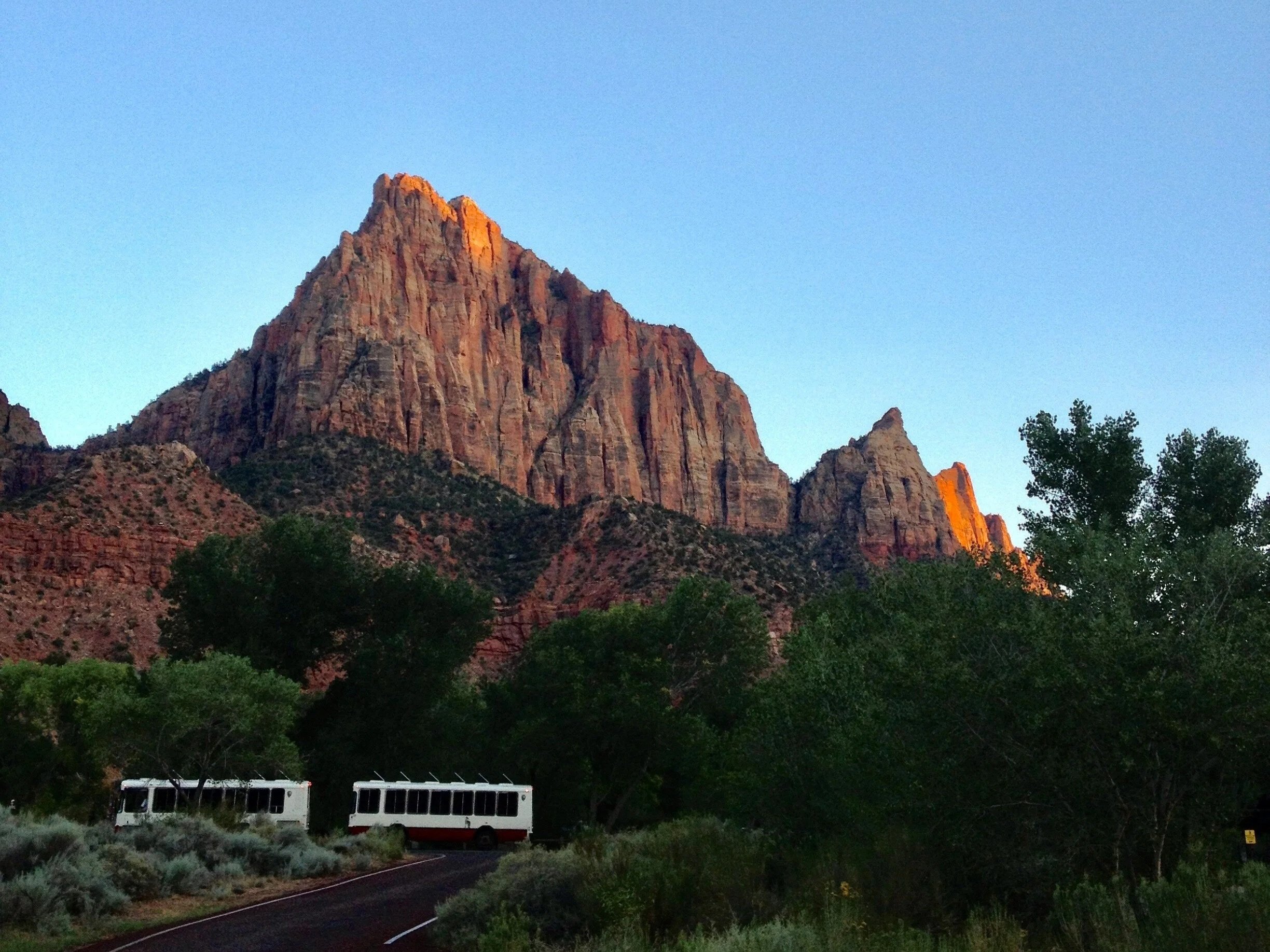
A free shuttle operates in Zion Canyon, running from the Zion Canyon Visitor Center along the Scenic Drive with stops at major trailheads such as Zion Lodge, Emerald Pools, the West Rim Trail (via The Grotto), and the Temple of Sinawava (the starting point for The Narrows). Private vehicles are not allowed on the Zion Canyon Scenic Drive beyond Canyon Junction during shuttle season (typically March through November).
The only exceptions are for Zion Lodge guests or those who obtain a special handicap pass at the Visitor Center. The shuttle operates on a first-come, first-served basis, and no advance tickets are required.
When the shuttle is not in operation (typically winter), private vehicles can typically drive the Scenic Drive.
Did you know that Zion National Park is known for being one of the world’s most climate friendly parks having won several prestigious awards for its efforts in the fight against global warming?
Zion Shuttle Schedule
Shuttles in Zion Canyon typically begin running early in the morning (often around 6:00–7:00 a.m.) and operate every 5–10 minutes throughout the day. The final shuttle usually departs from the Temple of Sinawava in the evening, with exact times varying by season—often between 7:00–9:00 p.m.
Because the shuttle runs on a first-come, first-served basis, lines can be long during peak times, and it’s possible to miss the last shuttle if you wait too late. If that happens, you may need to walk several miles back to the Visitor Center in the dark, so it’s important to plan ahead and catch an earlier return shuttle.
👉 Get my complete Guide to the Zion National Park Shuttle System for more infomation including shuttle stops and tips for taking the shuttle.
Zion is home to the largest flying bird in North America, the California Condor, which has an impressive wingspan up to 10 feet and can reach flight speeds of up to 55 mph.
✨ Pro Tip: All shuttle buses are wheelchair accessible. You can also bring strollers and bicycles but they must fit on the bike rack at the front of the shuttle.
ToThings to Do in Zion National Park
Weeping Rock
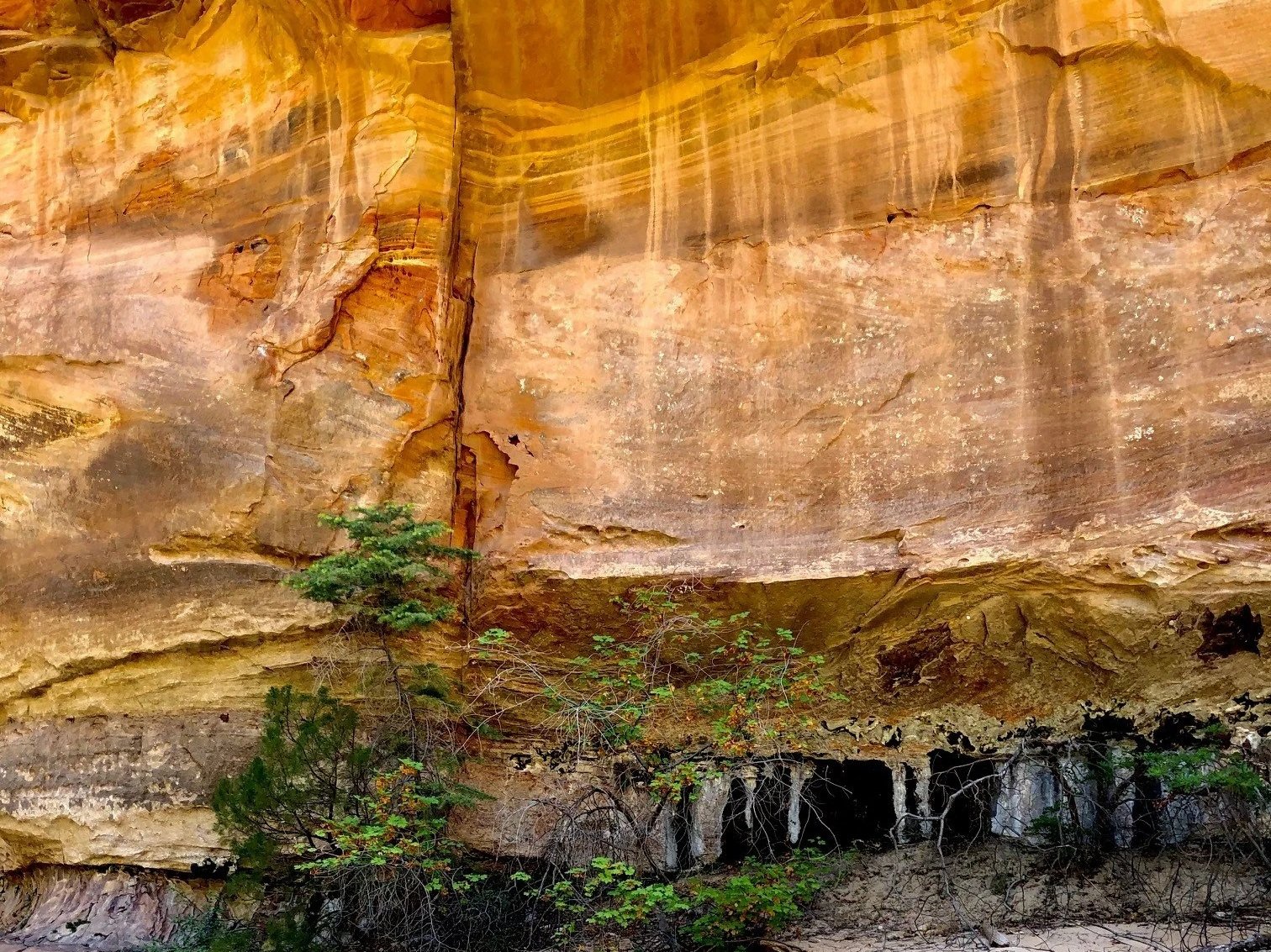
Weeping Rock is just a short hike to a beautiful area with lush hanging gardens. It’s a fascinating spot because the water you see dripping from the rock surfaces like tears has taken more than 1,000 years to percolate down through the porous, permeable Navajo sandstone.
It starts high above from its source in a natural, underground spring down to where you are standing.
Spring and fall are the best times to visit as the water flow will be at its peak. It gets crowded in summer and even though it’s open year round, it sometimes closes in winter due to icy conditions.
Important Note: Since late 2023, Weeping Rock had been closed due to significant rockfall damage from past storms. As of September 5, 2025, the Weeping Rock Trail and Shuttle Stop #7 have been reponened and visitors can hike the 0.4-mile trail to the "dripping alcove." However, nearby trails, including Hidden Canyon and the East Rim to Observation Point, remain closed as of early 2026. If you plan on hiking these trails, be sure to check the official national park website for updates.

Pa’rus Trail
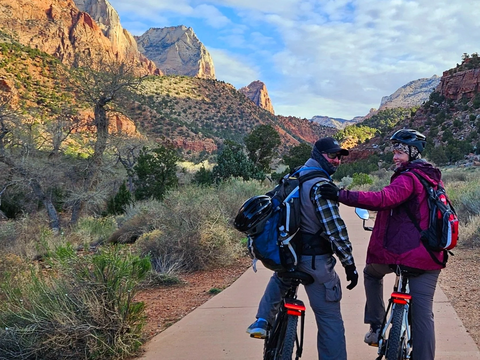
The Pa’rus Trail is a 3.5 mile roundtrip trail that runs from the Visitor’s Center to Canyon Junction. The paved trail follows the Virgin River and is great for bicycle riding or a leisurely stroll with minimal incline. It’s also a lot of fun to veer off the main trail and hike down to the water for a quick swim along the way. There are several trail side exhibits and it’s one of the few places pets are allowed.
Angel’s Landing
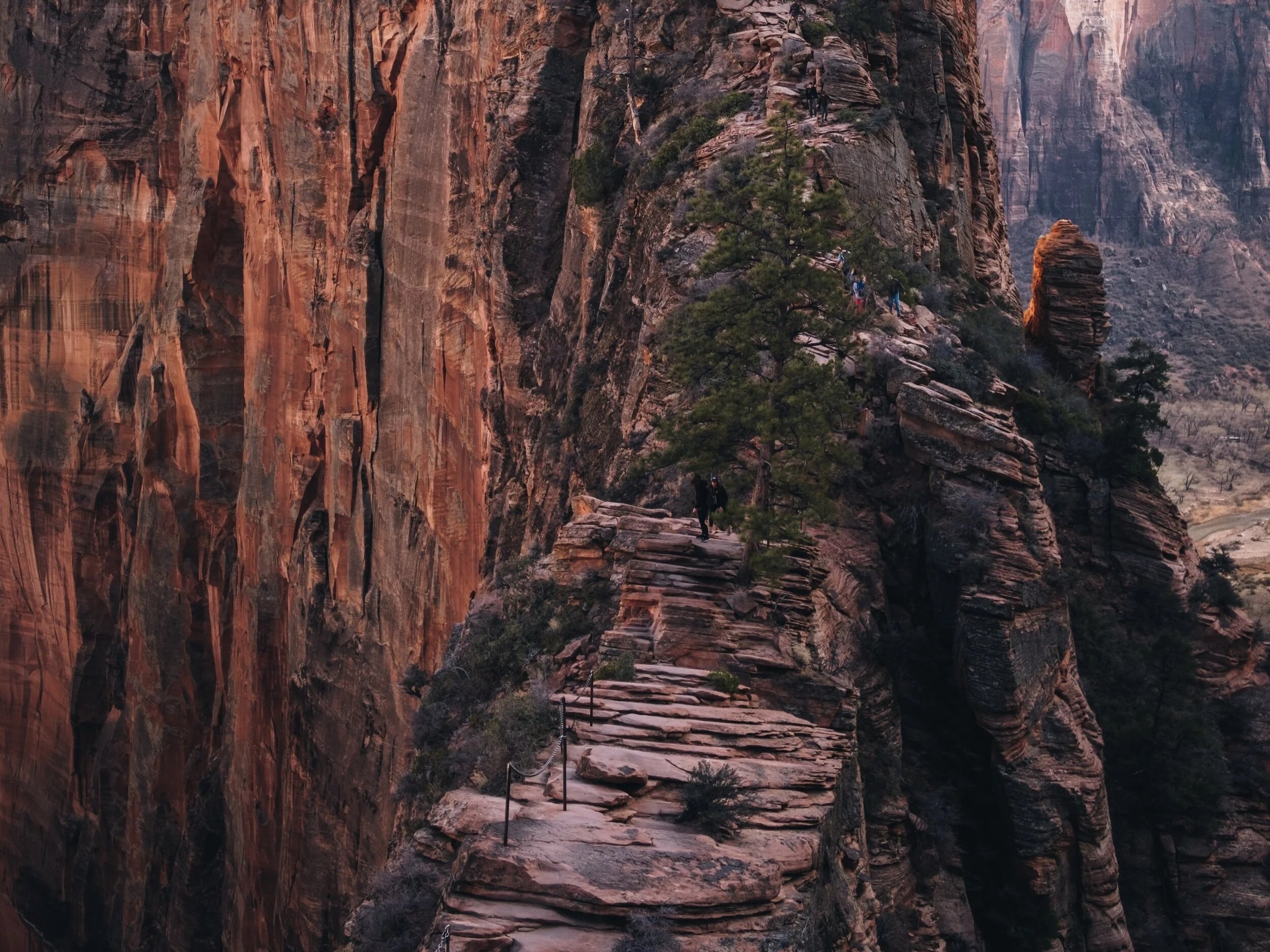
Angel’s Landing is known as one of North America’s most “dangerous hikes” which takes you high above the canyon floor on a narrow trail of switchbacks that traverse across exposed ledges with sheer cliff drop offs with stunning viewpoints. If you’re afraid of heights, this is not the hike for you. Know your limitations.
Angel’s Landing is a hike through a hanging valley in the heart of the park up steep cliffs with sheer drop-offs to stunning 360-degree views of the canyon below. It is one of the most impressive hikes but also one of the most dangerous in all of North America.
Once known as the Temple of Aeolus, the trail was cut into this 1,488-foot tall solid rock formation back in the 1920s. Although there are no permits or special instruction required to hike Angel’s Landing, it is important to use caution. Thirteen hikers have fallen to their deaths since 2000. One of the reasons it’s so dangerous is that there is exposed rock ledges and vertical drop offs, often with no guard rails. Some sections are extremely narrow with 1,000 foot drop-offs on both sides of the trail so be sure to use extra caution when passing slower hikers and take your time. Always be alert and cautious.
How to Hike Angels Landing Including Permits
🎟️Permits:
Everyone who hikes Angels Landing must have a permit issued by the National Park Service which are used to manage crowds for safety reasons.

Everyone who hikes Angels Landing must have a permit issued by the National Park Service which are used to manage crowds for safety reasons. You can apply for permits in advance through the seasonal lottery system or try for a last-minute permit the day before your hike.
🥾 Hiking
The hike to Angels Landing is approximately 2.4 miles each way, strenuous and will take approximately 3-6 hours. You can catch the trail from the Grotto Trailhead, the 6th stop on the Zion Canyon Shuttle.
This hike is not recommended for children or anyone with a fear of heights. Mid-mornings on weekends and holidays get extremely crowded which can make the hike much more dangerous. Try to hike during non-peak times.
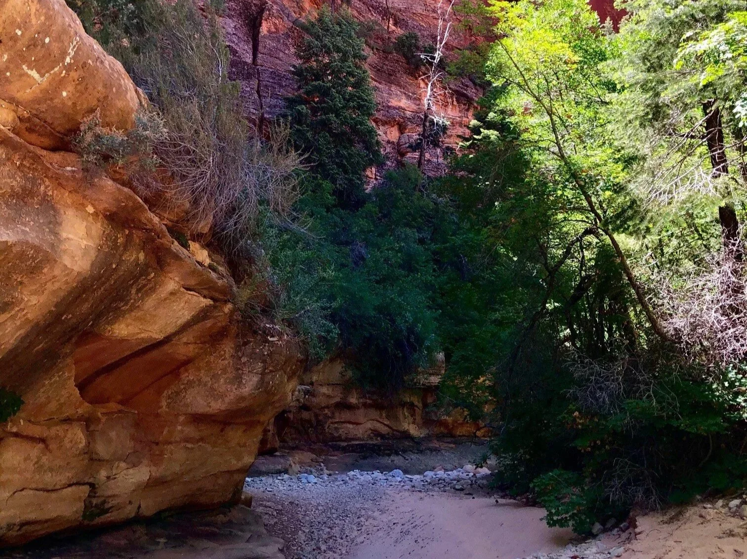
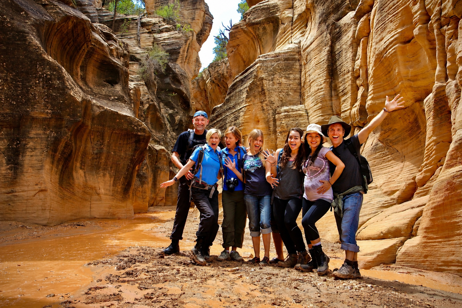
The Narrows
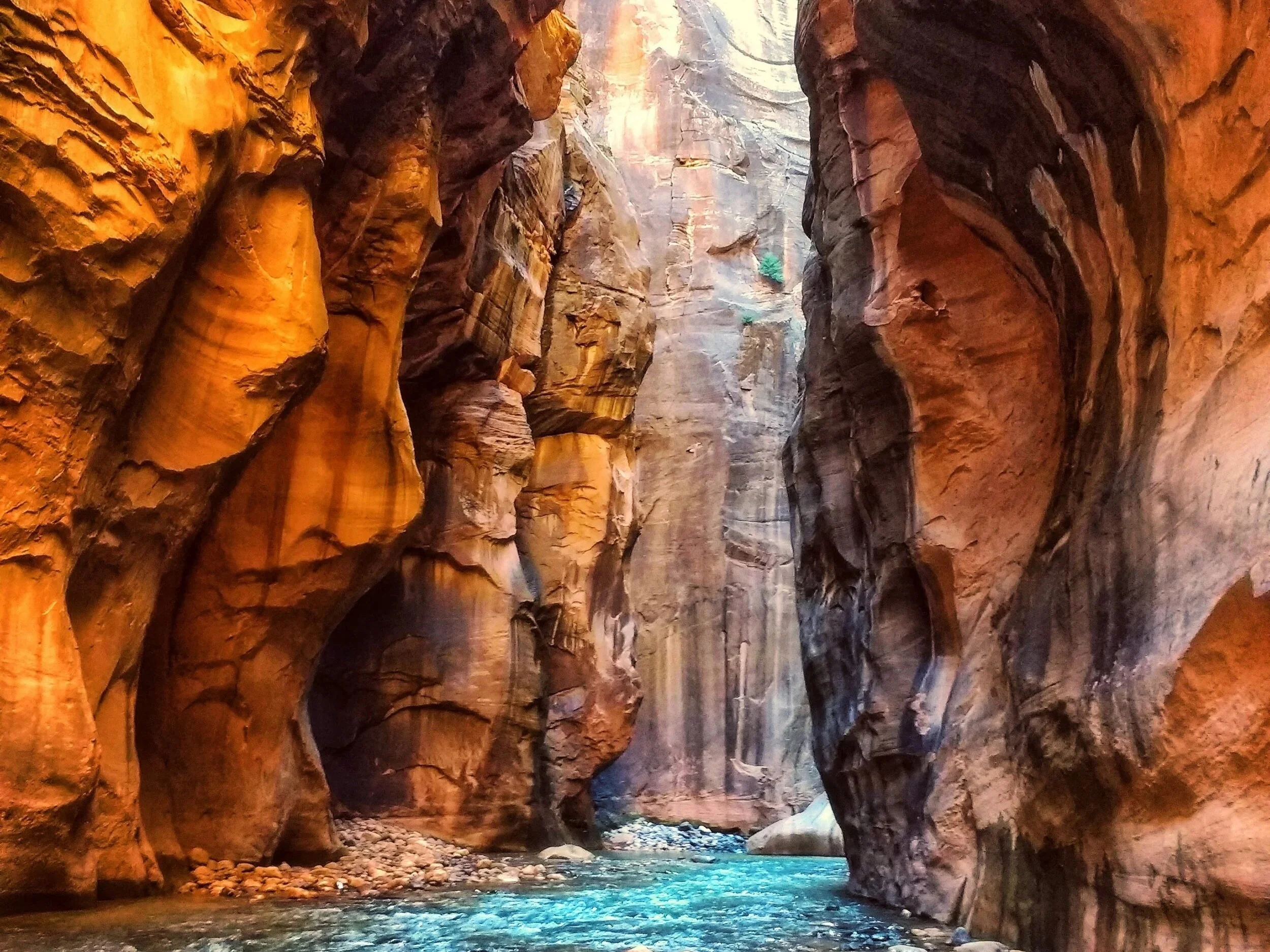
The Narrows was created when uplift gave water running through the North Fork of the Virgin River the force needed to cut through rock as it made its way to the ocean. The way Zion sits on the western edge of the uplift caused the water to tumble so rapidly off the plateau that it carried sediment and huge boulders down with it forming the deep, narrow canyon we find today. Photo: Karan Chawla, Unsplash.
The Narrows is one of the most popular hikes in the park. Appropriately named, it’s the narrowest portion of Zion Canyon where walls can reach over a thousand feet above the river in spots where the water is only 20-30 feet wide. It’s deepest point is 2,640 feet down. As you travel through the iconic slot canyon, you will hike through an incredible gorge full of sandstone grottos, natural springs and hanging gardens.
🥾 How to Hike The Narrows
There are two ways to hike the Narrows. Regardless of which you choose, your feet are going to get wet as you literally hike in the Virgin River. The river is the trail.
Hike from the Temple of Sinawava
Most people hike the Narrows from the bottom up, starting at the Temple of Sinawava. A shuttle stop drops you right at the trailhead—just follow the Riverside Walk to the end, then continue upstream through the Virgin River.
You can hike just a short distance into the Narrows or go as far as Big Spring, about 9–10 miles round trip, depending on conditions and how far you want to go.
This route takes you through some of the most scenic sections of the canyon and is absolutely stunning. Big Spring is the turnaround point for bottom-up hikers—you are not permitted to continue farther upstream or access backcountry campsites from this direction.
⚠️Important to Know: All overnight backpackers must hike the Narrows from the top down, starting at Chamberlain’s Ranch. No permit is required for the bottom-up Narrows hike.
Hike down The Narrows from Chamberlain Ranch
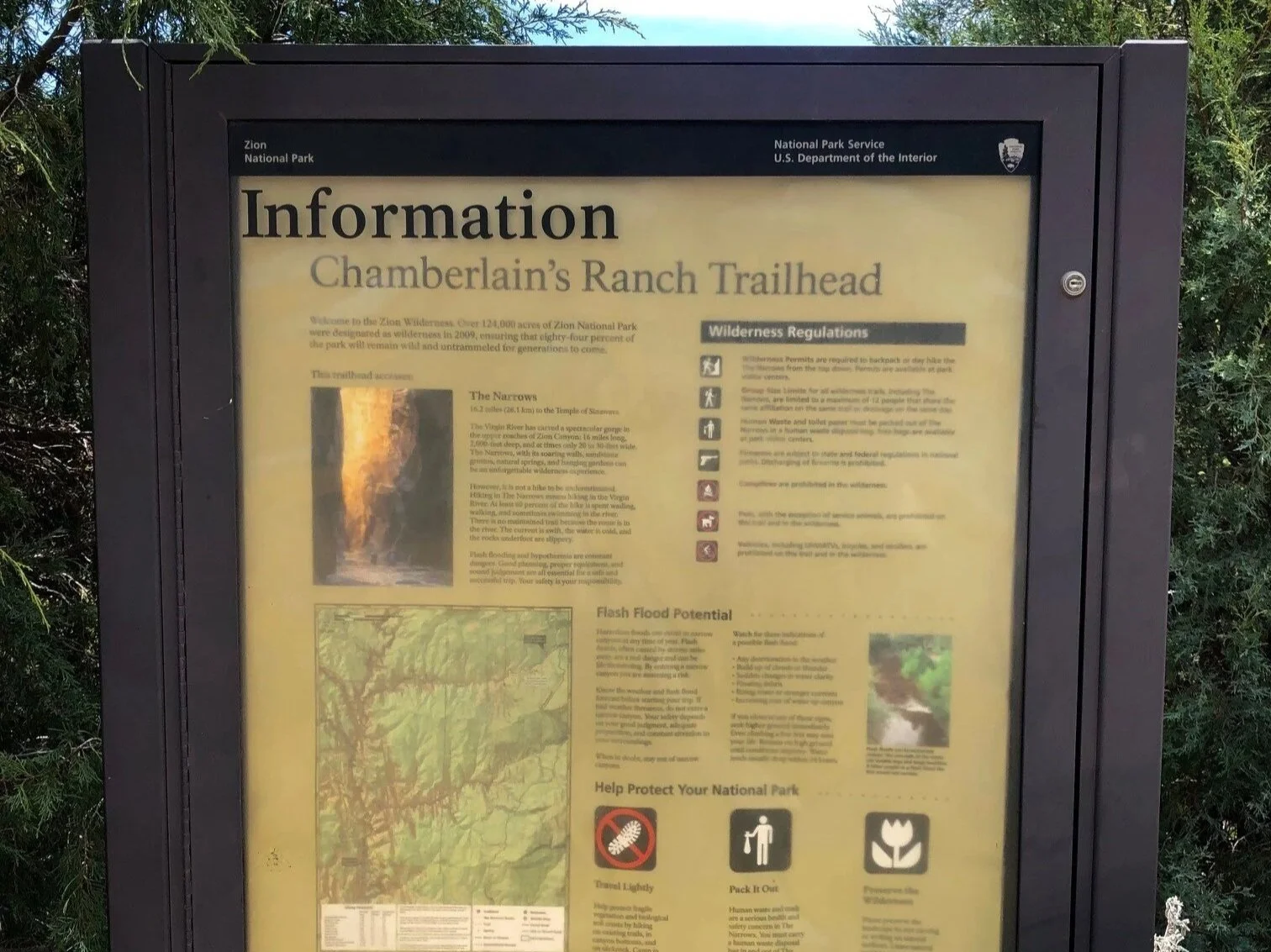
If you’re up for a bigger adventure, you can hike the Narrows from the top down starting at Chamberlain’s Ranch. This route is about 16 miles long, descending roughly 1,300 feet through the canyon before ending at the Temple of Sinawava.
A wilderness permit is required for this hike. Most visitors complete it as a long day hike or an overnight backpacking trip, though multi-day trips are allowed with the proper permit. Be sure to check weather conditions carefully, as flash flooding can make this hike dangerous.
🎟️ Wilderness Permit Fees
$15 for 1-2 people
$20 for 3-7 people
$25 for 8-12 people
There is also a $5 non-refundable reservation fee for advance bookings which are recommended.
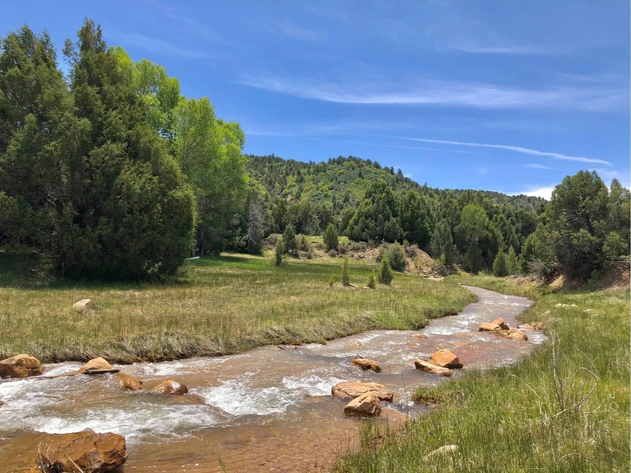
Chamberlain’s Ranch where you begin the 16 mile hike down through the Narrows to the Temple of Sinawava.
🎟️ Reservations for The Narrows
Reservations (permits) are required for hiking the Narrows from the top down. Advance permits can be reserved online starting at 10:00 a.m. Mountain Time on the 5th of each month for the following month. These spots often fill within minutes, so it’s important to plan ahead.
If you miss advance reservations, a limited number of permits are available through a last-minute lottery system closer to your trip dates. You can check availability and apply for permits online here.
🥾 Tips for Hiking The Narrows
Never hike The Narrows if there is a flash flood warning. It’s extremely dangerous as you can get trapped in high water and floods that come out of nowhere even in just light rain. Be sure to check the weather forecast and flash flood potential before heading out. Note that the Narrows is often closed during spring snowmelt in April and May for this very reason.
Travel is rough and slippery through water that can be cold and fast-moving. Much of the hike is wading, walking or even swimming in the river. You will find yourself in chest deep or waist high water about 5% of the time and knee deep or less water about 45% of the time. Specialized water shoes, neoprene socks, walking sticks, dry suits and other dry gear are recommended. If you don’t want to purchase gear, you can rent it at local shops like Zion Outfitter or Zion Adventures. Most stores also offer essential risk management education.
Always check current conditions for critical safety alerts.
East Side of Zion and Scenic Drive
At the time of its completion in 1930, the Zion-Mt. Carmel Tunnel was the United States’ longest tunnel at 1.1 miles long.
If you plan on driving a vehicle through the tunnel that’s 11’4” tall or taller and/or 7’10” wide or wider, including all awnings, racks and mirrors, you must obtain a tunnel permit at the entrance station and pay a $15.00 permit fee. The pass is good for up to two trips within 7 days from the purchase date.
Many visitors never leave Zion Canyon where the trams run and have no idea what they’re missing. Although, the trams takes you to some of the most incredible viewpoints and must-sees in the park, everyone visiting really should take a leisurely drive down the Zion-Mt. Carmel Highway, one of my favorite byways and the gateway to exploring places like neighboring Bryce Canyon, the Coral Pink Sand Dunes and other parts of Utah.
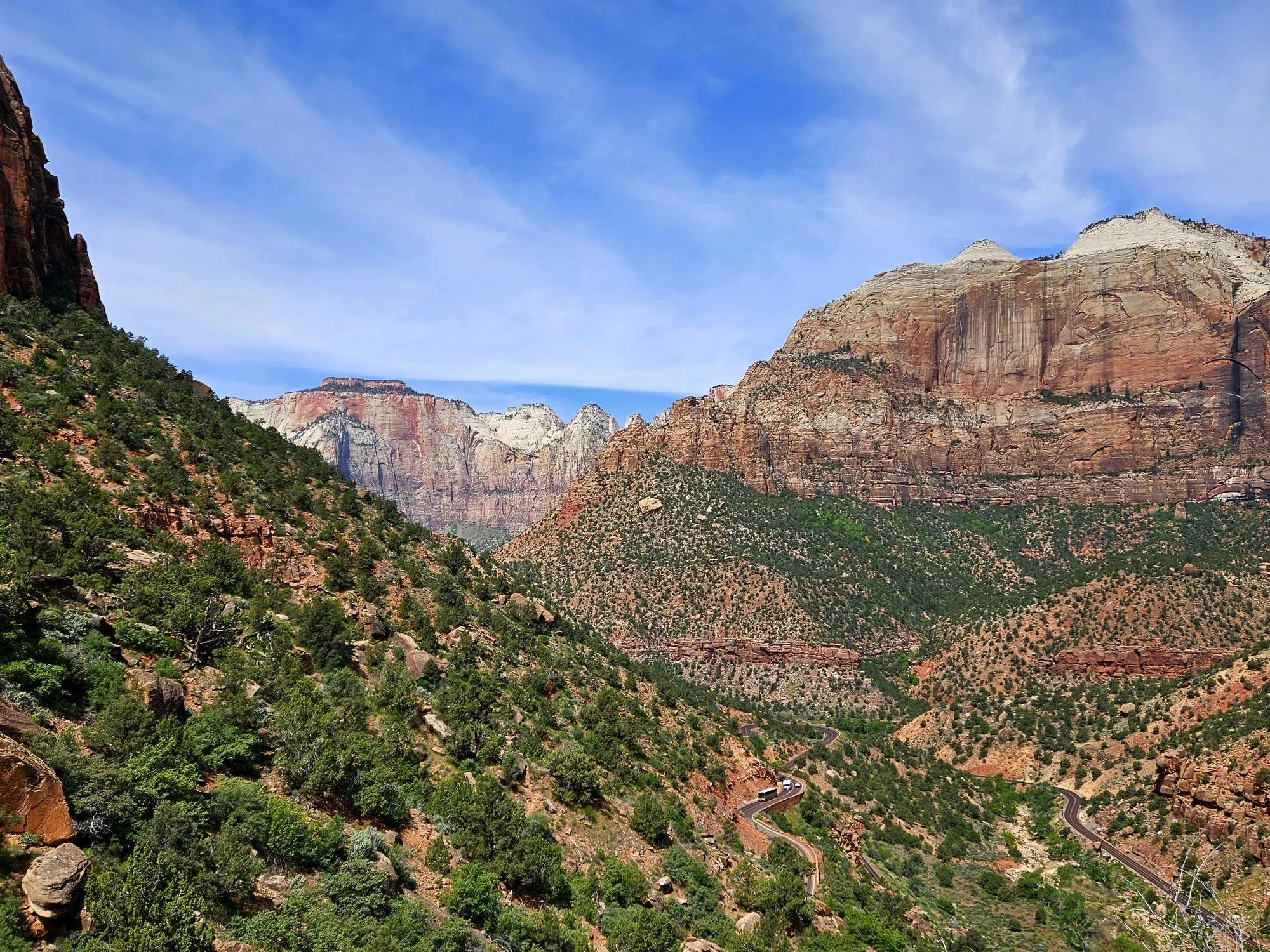
The 12-mile switchback scenic highway takes you through some of Zion’s most impressive landscapes and allows you to explore the east side of the park full of checker board mesas, hoodoos and other unique geological features.
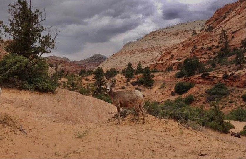
It’s also the best chance you have of spotting Zion’s big horn sheep which roam the area.
Thanks to their split hooves and amazing balance, these impressive animals can stand on ledges only 2-inches wide, jump 20 feet at a time and scale up rocky mountain slopes and outcrops at up to 15 mph.
The Perfect 1-Day Zion Itinerary
Only have one day to explore Zion National Park?
If you're short on time, here's the route I'd recommend. This 1-day itinerary includes many of Zion National Park's must-see sights. It's the perfect way to experience the highlights in a single day.
🌅 Arrive before 7:30 a.m.
🚌 Ride the shuttle into Zion Canyon.
🥾 Hike Angels Landing or Scout Lookout.
🥪 Lunch at Zion Lodge or a packed picnic.
🌿 Emerald Pools or Riverside Walk.
🌊 Walk into The Narrows (if conditions allow).
🌄 Sunset at Canyon Junction Bridge.
👉 Have more time and want to escape the Zion crowds? Check out my complete 5-Day Zion National Park Itinerary, where I share additional hikes, scenic drives, and nearby destinations for a more relaxed and memorable adventure.
FAQs for Visiting Zion National Park
🎟️ Do you need a reservation to enter Zion National Park?
No, reservations are currently not required to enter Zion National Park. You can enter on a first-come, first-serve basis by paying the entrance fee or using a national parks pass. Be sure to arrive early as the wait times can be very long especially in peak seasons.
📅 What is the best time to visit Zion National Park?
The best time to visit Zion is in the spring (March–May) or fall (September–November), when temperatures are mild and ideal for hiking. Summer can be extremely hot. While winter is quieter with fewer crowds, it can also be quite cold and snow is not uncommon.
⏰How early should you arrive at Zion National Park?
It’s best to arrive early, ideally before 8:00 a.m. especially during peak season. The parking at the Visitor Center fills quickly, and shuttle lines can be extremely long especially later in the day.
⏰ How long do you need in Zion National Park?
Plan to spend at least 2–3 days in Zion National Park. With more time, you’ll be able to explore at a relaxed pace and experience more of the park’s incredible hikes, viewpoints, and scenery.
🎟️ Do you need a permit to hike the Narrows?
A permit is only required for hiking The Narrows from the top-down starting at Chamberlain’s Ranch. The most popular way to hike it is from the bottom-up hike starting at Temple of Sinawava which does not require a permit.
🎟️ Do you need a permit to hike Angels Landing?
Yes, a permit is required to hike Angels Landing. The National Park Service uses a lottery system to manage crowds on this popular trail. You can apply for permits in advance through a seasonal lottery or try for a last-minute permit the day before your hike.
More Zion Travel Guides
5-Day Zion National Park Itinerary - How to Spend 5 Days Without the Crowds
Zion National Park Shuttle System - Everything You Need to Know
Zion National Park - Open Sky Zion - Luxury Glamping
Zion National Park - One of the World’s Most Climate Friendly Parks
Zion National Park - Climate Change Endangers Beloved Park
